

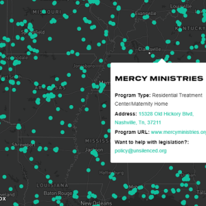
An interactive map, which displays a comprehensive list of congregate care facilities reported to the California nonprofit public benefit corporation – “Unsilenced Project”.

This interactive map helps the user to visualise the most optimal development zones for charging infrastructure in regional towns, key routes/highways and metropolitan areas of New South Wales, Australia. The user can identify and see details about potential development zones that need charging infrastructure, by viewing key information for business case development such as traffic volumes, proximity to amenities and proximity to grid infrastructure. The map provides a time slider, which allows the user to track the changes of multiples layers. The map is published on the website of the New South Wales, Australia state government.

An interactive map of listeners and radio servers around the world. The data is loaded at some intervals from an external API.

An interactive map of UFO cases in the USA. The map provides slideshow gallery for each case.

An interactive map which shows the agencies, which work with the US company “Intelligent Pole Base”.

An interactive map with a time slider, which allows the user to track the spread of the children in Ghana, whom the “Mercy Project” organization has helped rescue from child slavery.
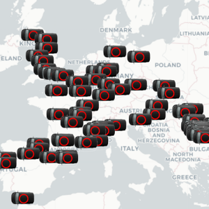
An interactive map of vans positions around Europe. The vans are displayed with animated icons. The data is loaded at some intervals from an external API.

Online animated map of the tourist path in Australia