


An interactive map with a time slider, which allows the user to track the spread of the children in Ghana, whom the “Mercy Project” organization has helped rescue from child slavery.

An interactive map, which shows the places in Finland for which the client’s website sells fishing permits. The map also provides a live search feature.

An interactive map which shows the locations of the fountains in Bulgaria. The map is part of the project “Zero Waste Sofia”, created by Simona Stiliyanova – co-founder of “Osnova”. I also created a map, which contains only the fountains in Sofia, which is part of the “Stolichna H2O” project.
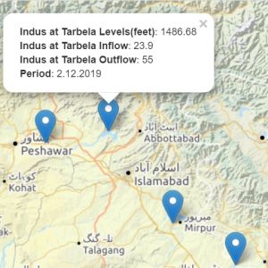
An interactive map, showing inflows and outflows data in Pakistan. The user can select from 5 different base maps.

An interactive map, which displays the locations of the beer breweries in Belgium.
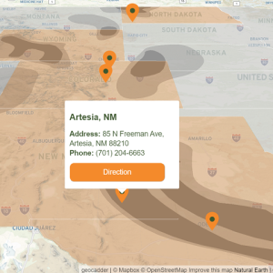
An interactive map, which show all Rolfson Oil company locations in USA.

Online map with customized markers, the data for which is loaded from a JSON file

Online map of foot points of interest in Hamburg, Germany, with clustering and combining the points into different categories