


Mize Representatives
An interactive map, which shows the representatives of the US company “Mize Farm & Garden”.

Animated Routes between POIs
Online map of animated routes between points of interest in San Francisco, USA

ZZP Projecten
An interactive map, which displays the projects locations of the Dutch company “ZZP Projecten”.

Marsham Retailers
An interactive map, which shows the retail coverage of the Canadian company “Marsham International Food Brokers”.
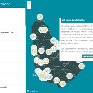
Rogues in Paradise

Ghana Mercy
An interactive map with a time slider, which allows the user to track the spread of the children in Ghana, whom the “Mercy Project” organization has helped rescue from child slavery.

Coronavirus in Bulgaria
An interactive map with a time slider, which allows the user to track the spread of the virus in Bulgaria

Covid-19 Testing Locations
An interactive map, which shows the Covid-19 testing locations.